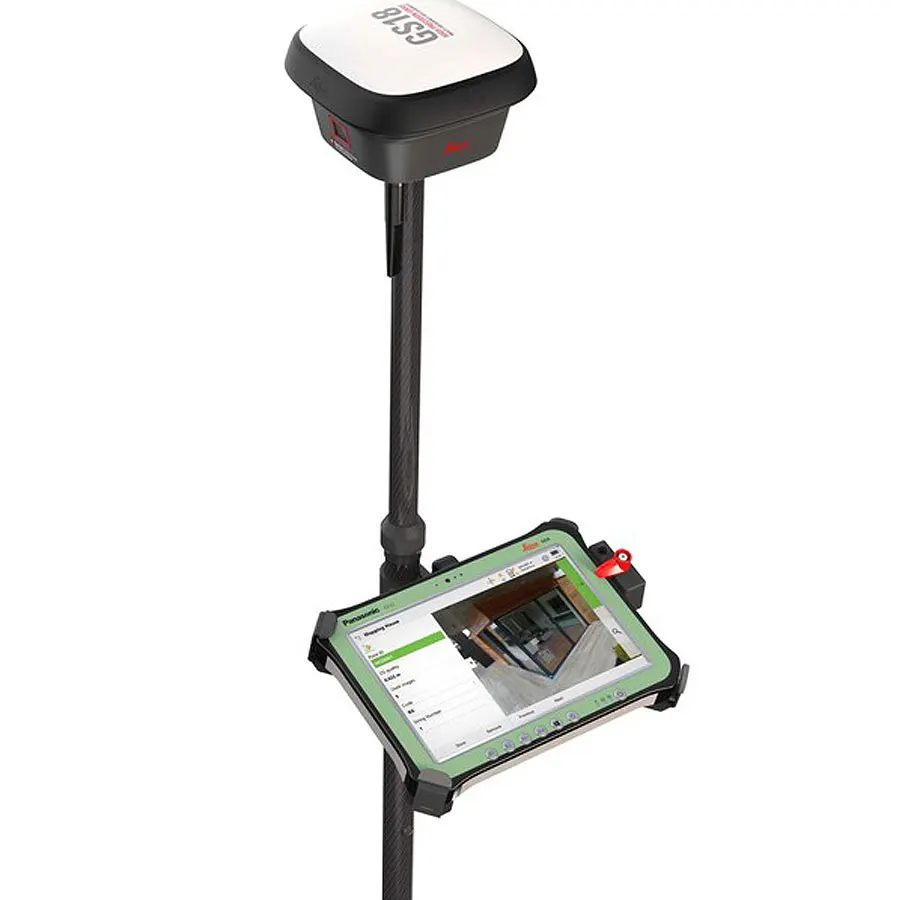
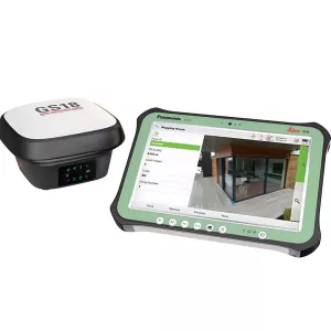
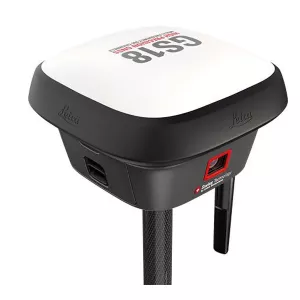
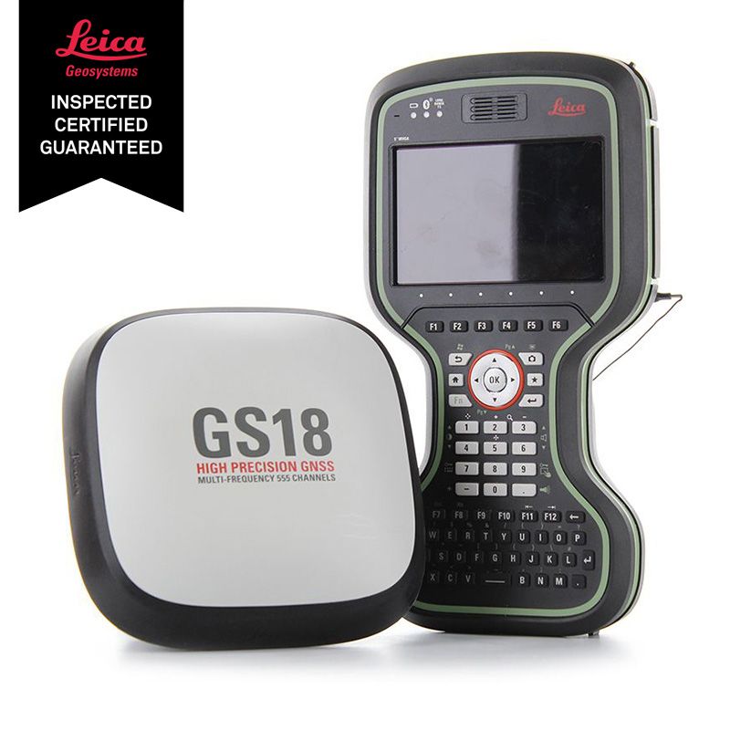
LAST UNIT!! Get this NEW Leica GS18 I GNSS Rover with CS20 LTE Field Controller SET also available optionally may be paired with a Leica CS35 tablet with a 15% discount. This set GNSS RTK Rover with Visual Positioning, Measure what you see!
LAST UNIT!! Get this NEW Leica GS18 I GNSS Rover with CS20 LTE Field Controller SET also available optionally may be paired with a Leica CS35 tablet with a 15% off discount. This set GNSS RTK Rover with Visual Positioning, Measure what you see! Mapping and surveying just got simpler, safer and more efficient than ever before. Meet the Leica GS18 I GNSS RTK rover with Visual Positioning. With it, you can effortlessly measure points you couldn’t reach before. Capture the site with GS18 I and map points from images. A GNSS RTK rover, so innovative, that you can accurately measure facades and corners without needing to switch tools. Once you capture the site, you can measure every detail whenever you want to.
Innovative
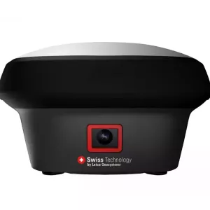
The Leica GS18 I is an accurate and easy to use GNSS RTK Rover. It utilises highly innovative Visual Positioning technology based on seamless integration of GNSS, IMU and a camera. It enables you to measure survey grade points in images on site and in the office. Create point clouds from captured data with Infinity to expand possibilities even further.
Leica GS18 I - FastFast
Designed to measure large amounts of points efficiently. Leica GS18 I allow you to capture images and measure hundreds of points within minutes, also places which cannot be physically accessed. Using images to measure these points, allows you to reduce time spent onsite and cut down re-work: once you captured the site, you have every detail measured.
Leica GS18 I - VersatileVersatile
Imaging power has changed the rules of the game. By having the power to measure what you see, you can now reach places you couldn’t before without switching tools or climbing through obstacles. That gives you the flexibility in the field, frees up equipment and crews, and truly maximises productivity in your projects, which results in increased profits.
Number of channels 555 (more signals, fast acquisition, high sensitivity)
Tilt compensation Increase measurement productivity and traceability Calibration-free Immune to magnetic disturbance
IMAGING:
Camera Sensor Global shutter with 1.2 MP
Field of view (HZ / V) 80° / 60°
Frame rate 20 Hz
Image group capture 2 Hz capturing rate Max. capturing time: 60 s Size of an image group with a 60 s capturing time: appr. 50 MB
Working range 2 m - 10 m distance to object of interest
Point cloud Leica Infinity Derive point cloud from an image group
MEASURMENT PERFORMANCE & ACCURACY4:
Time for initialisation Typically 4 s
Real-time kinematic (Compliant to ISO17123-8 standard) Single baseline Hz 8 mm + 1 ppm / V 15 mm + 1 ppm
Network RTK Hz 8 mm + 0.5 ppm / V 15 mm + 0.5 ppm
Real-time kinematic tilt compensated Topographic points (not for static control points) Additional Hz pole tip uncertainty typically less than 8 mm + 0.4 mm/° tilt down to 30° tilt
Post processing Static (phase) with long observations Hz 3 mm + 0.1 ppm / V 3.5 mm + 0.4 ppm
Static and rapid static (phase) Hz 3mm + 0.5 ppm / V 5 mm + 0.5 ppm
Code differential DPGS / RTCM, Typically 25 cm
Image point measurement 1-tap measurement in field/office, Typically 3 cm – 5 cm (3D)1
COMMUNICATIONS:
Communication ports Lemo USB and RS232 serial
Bluetooth® Bluetooth® v2.1 + EDR, class 1.5
WLAN 802.11 b/g for field controller communication only
Communication protocols RTK data protocols Leica, Leica 4G, CMR, CMR+, RTCM 2.2, 2.3., 3.0, 3.1, 3.2 MSM
NMEA output NMEA 0183 v4.00 and Leica proprietary
Network RTK VRS, FKP, iMAX, MAC (RTCM SC 104)
Built-in LTE modem LTE frequency bands Penta Band (20, 8, 3, 7, 1) / Penta Band (13, 17, 5, 4, 2)5
UMTS frequency bands Tri Band (900/1800/2100 MHz) / Tri Band (1700/1900/2100 MHz)5
GSM frequency bands Dual Band (900/1800 MHz / Quad Band (850/900/1800/1900 MHz)5
Built-in UHF modem Receive & transmit UHF radio modem 403–473 MHz, channel spacing 12.5 kHz, 20 kHz, 25 kHz, max. 1 W output power up to 28800 bps over air
External data links Generic serial interface for phone modems and UHF/VHF radio modems