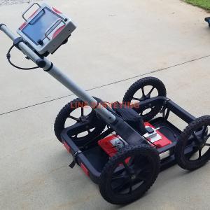

ImpulseRadar PinPointR Ground Penetrating Radar Utility Locator has been developed to maximize in-field productivity by utilizing ImpulseRadar’s innovative real-time sampling (RTS) dual-channel antenna technology, which provides incredible bandwidth, speed, and resolution, all controlled via an intuitive Android-driven user interface. The ImpulseRadar PinPointR offers a clear and dependable way to quickly and easily locate, avoid or map underground utilities with the functionality required to meet approved industry standards, whilst offering market-leading performance and data quality.
Includes:
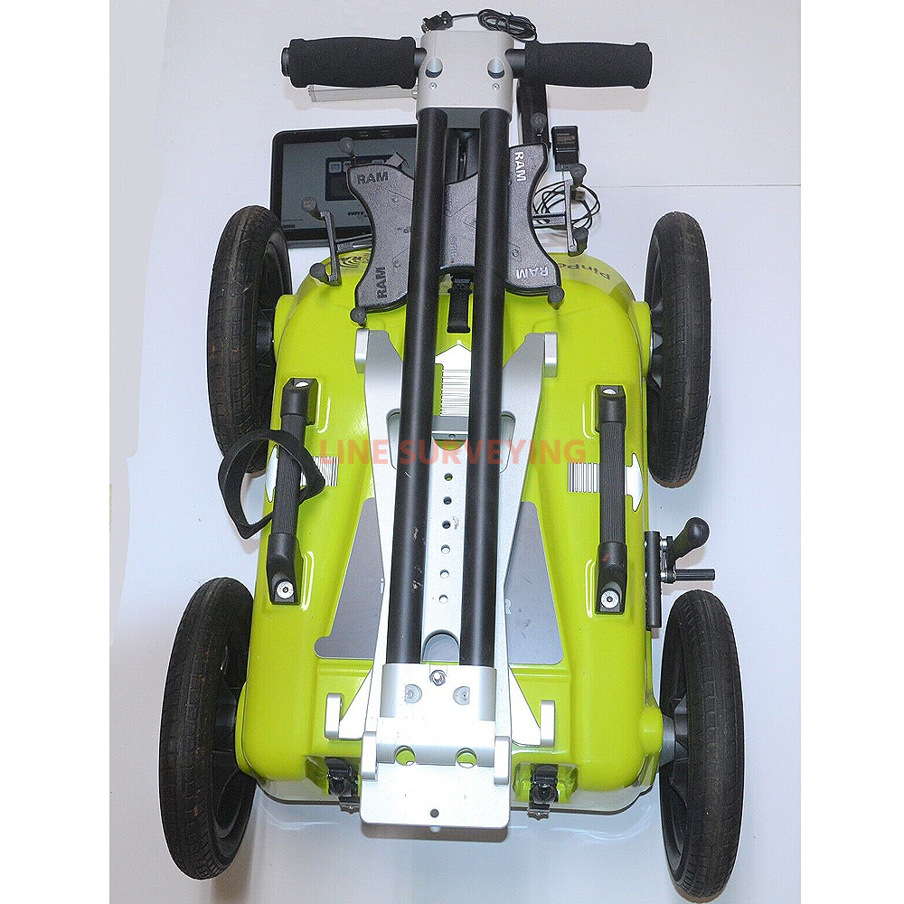
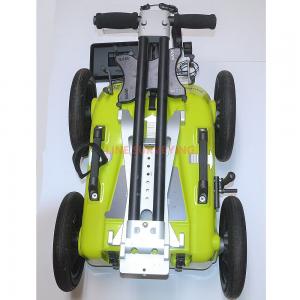
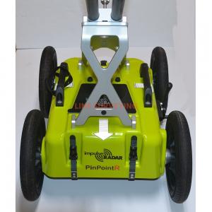
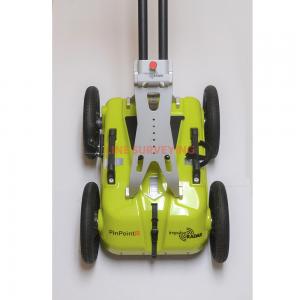
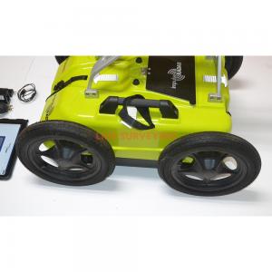
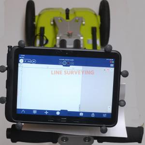
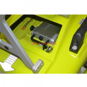
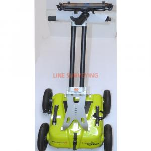
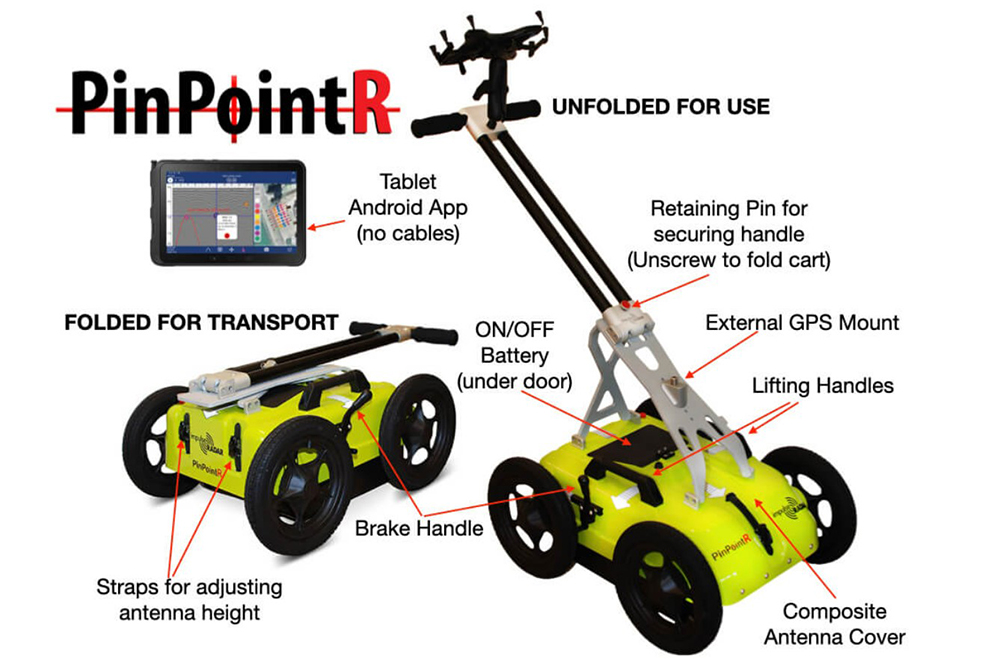
ViewPoint mapping, ease-of-use operation, dual channel radar antenna (400/800MHz), (RTS) Real-time sampling technology, a composite weather antenna cover, lightweight folding cart, large off-road wheels, fully wireless Android tablet operation, *Ruggedized Tablet 10.1”/TFT, MIL-STD-81DG and IP68 rated, accurate built-in GPS (also accepts optional external RTK-GNSS), provides automatic utility report generation which verifies site visit & ticket sign-off, long-lasting Li-Ion battery (7-hour).
FEATURES:
1. ImpulseRadar Real-Time Sampling (RTS) based antenna technology: Quick, clear and dependable locates to maximise in-field productivity and decision-making.
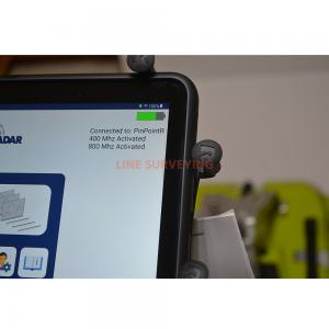
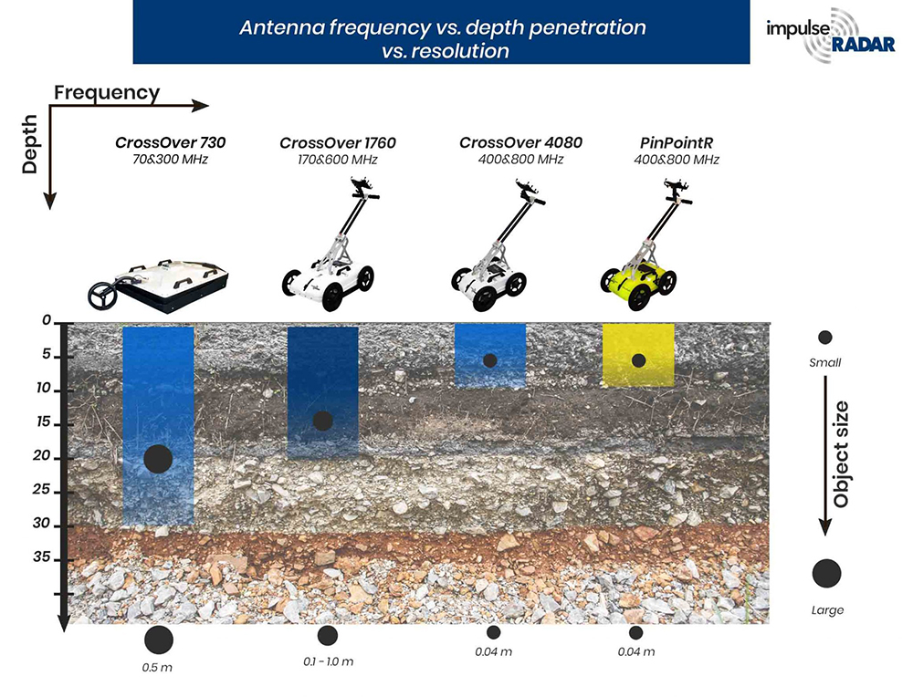
2. Dual channel operation400 MHz (LF) and 800 MHz (HF): One-pass locates with full depth range improves locating efficiency and decision-making.
3. Wireless data acquisition: No cables to be lost or broken which simplifies set-up and in-field productivity, and minimises operational servicing costs.
4. Android-driven user interface: Flexibility in choice of acquisition device.
5. 7-hour battery life: Low power consumption to extend working time.
6. Internal GPS: Geo-referenced data as standard.
7. Supports external GPS: Compatible with DGPS or RTK-GPS for higher accuracy geo-referencing for mapping/reporting purposes.
8. Automatic utility report generation: Simplifies report generation and proves site visit for job/ ticket sign-off.
9. ViewPoint App: The Android data acquisition App includes industry standard marker functionality (APWA, AS5488, or user-defined) to enable users to mark-up data in the field to correlate with the actual paint marks they put on the ground and any subsequent field sketches or report outputs.
10. Download: ImpulseRadar PinPointR GPR Utility Locator Brochure
| ANTENNA: | |
| Antenna type | PinPointR dual-channel / RTS real-time sampling technology |
| Center frequency | Ch-1: 400 MHz / Ch-2: 800 MHz |
| Signal to noise ration (SNR) | >100 dB |
| Significant/number of bits | >16 bitSensor: -40°F to +122°F (-40°C to +50°C) DVL: +23°F to +122°F (-5°C to +50°C) |
| Scan/second | >800 |
| Survey speed | >130 km/h (80.7 mph) @ 5 cm point interval |
| Time window | 388 ns (LF) / 194 ns (HF) |
| Bandwidth | >120%, fractional, -10 dB |
| Acquisition mode | Wheel, time or manual |
| Positioning | Wheel encoder, internal DGPS, external GPS (NMEA 0183 protocol) |
| Power supply | 12 V Li-Ion rechargeable battery, or opt. ext. 12V DC source |
| Power consumption | 1.3 A |
| Operating time | 7 hours |
| Dimensions | 17.5” x 14” x 7.6” (antenna) |
| Weight | 14 lbs. (antenna - including battery) |
| Operating temperature | -7.6°F to +122°F (-20°C to +50°C) |
| Environmental | IP65 rated |
| Regulatory certification | Approved (FCC, CE & IC) |
| CART: | |
| Dimensions (folded for transport) | 34.25” x 21.25” x 14.6” |
| Dimensions (when in use) | 39.75” x 21.25 x 40.55” |
| Wheels | 12.4” (off-road style) |
| Weight | 28.2 lbs. (Cart only), 44 lbs. (Cart, Antenna & Tablet) |
| USER INTERFACE Requirements: | |
| Display | 720 x 1280 pixel or better |
| Operating system | Android™ (>Version 5 Lollipop) or later |
| Memory | 2.7 GB SDRAM or better |
| Processor | Intel Atom x5-Z8550, Quad-core 2.3 GHz Krait 400 or better |
| Recommendation | Samsung Tab Active Pro - Ruggedized Tablet w/Android 9 (Pie), Qualcomm SDM670CPU, 2-GHz, Octa-Core processor |
| Applications |
Utility Locating Infrastructure Road/Bridge inspection Law enforcement & Military Environmental Archaeology |