Description
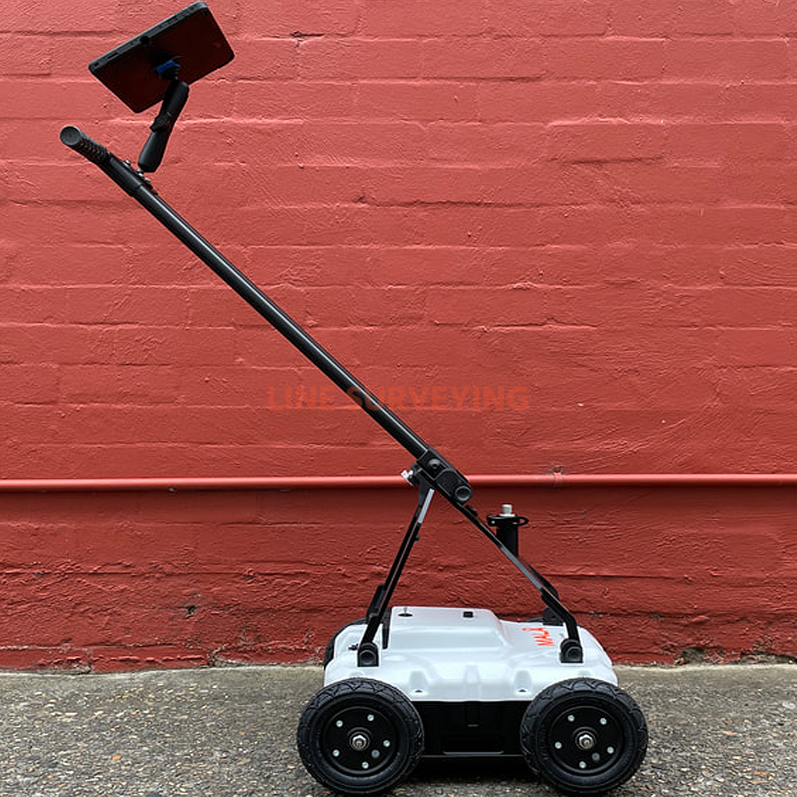
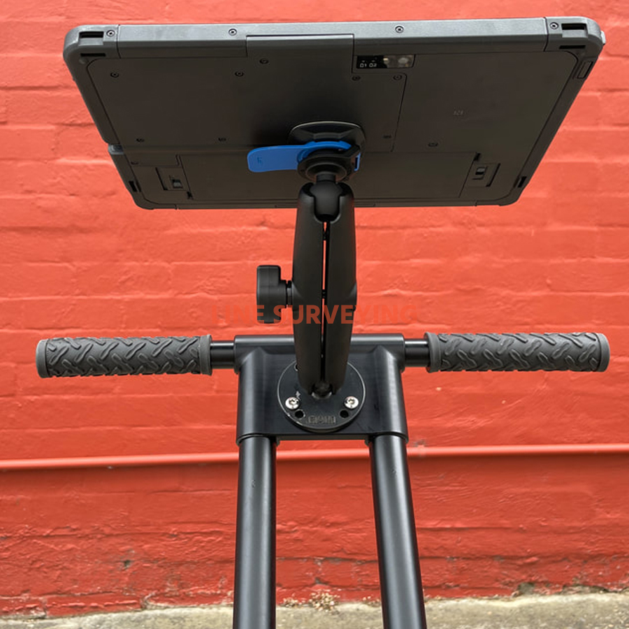
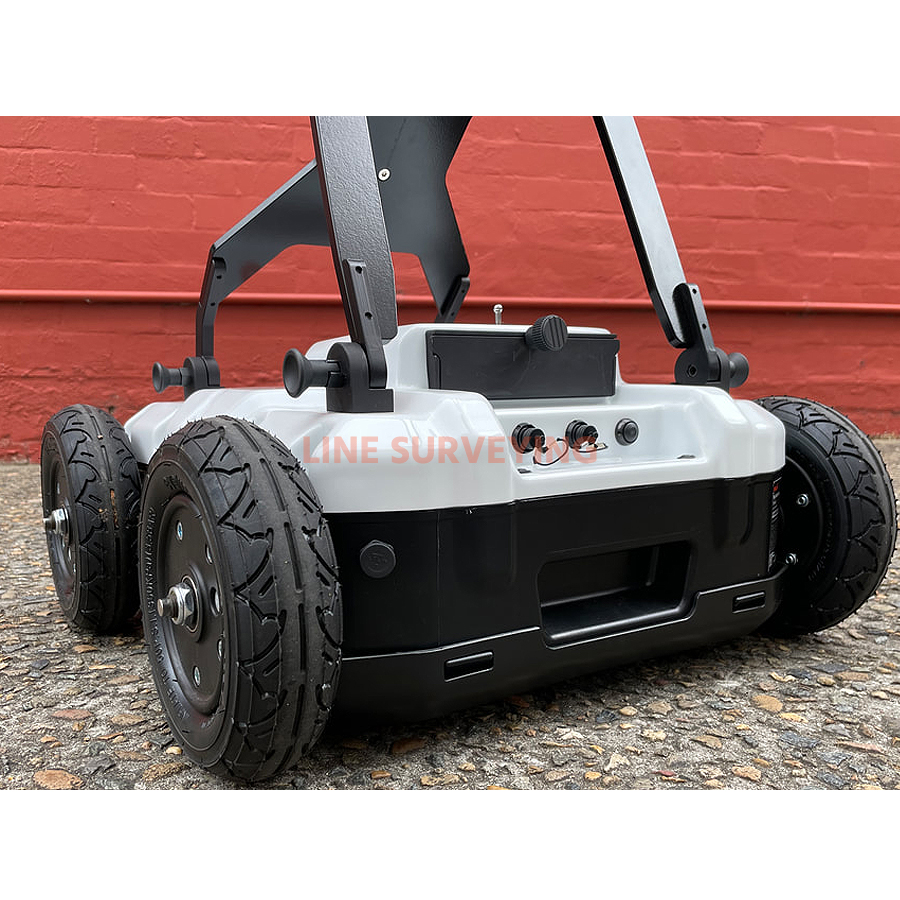
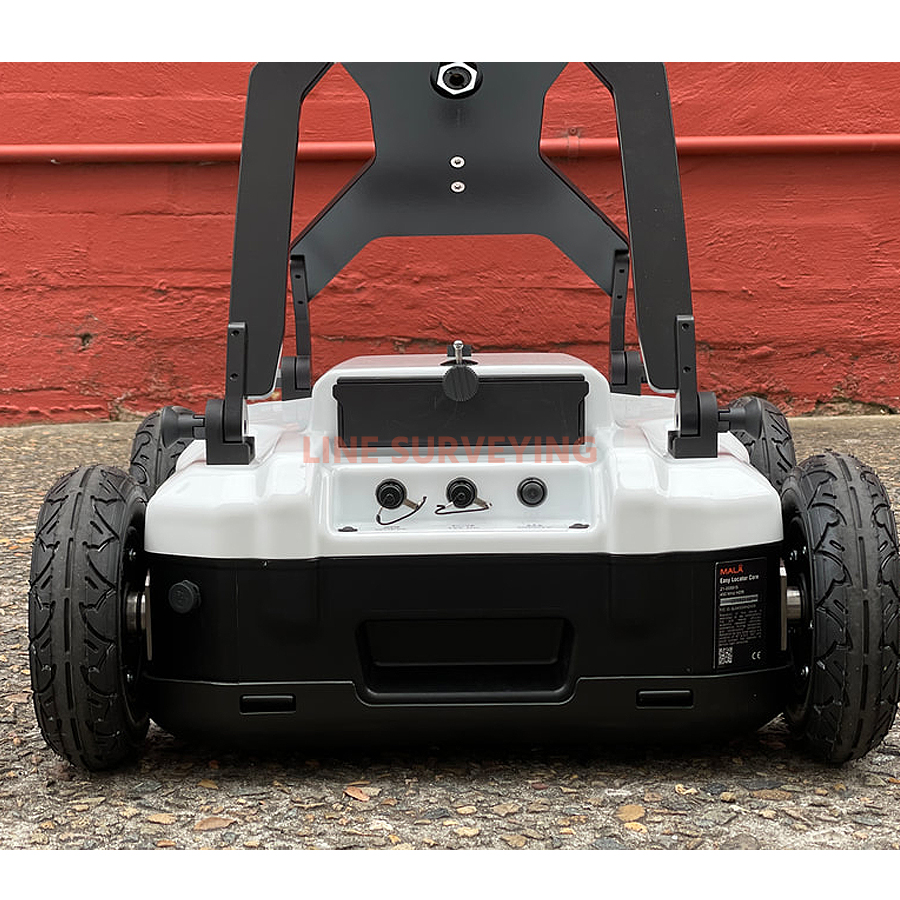
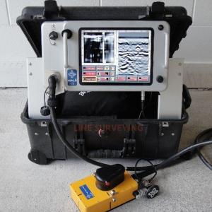
For sale excellent condition demo used MALÅ Easy Locator Core Standard package include Easy Locator Core, Dual Li-Ion Battery Charger and a MALA Vision Premium – 3 months subscription (Prepaid) and Samsung Galaxy Tab Active Pro 4G+ MALÅ Turnkey config and RTC Mini cart for EL Core. Please contact us for more info!!
MALA Easy Locator Core Real-time MALÅ AI interpretation support is a revolution in the GPR world. MALÅ Easy Locator Core is the first product world-wide using intelligent real-time interpretation support for utility locating. All markers set by MALÅ AI can be converted to standard markers with localized utility color codes directly in the field. This provides an invaluable interpretation support for inexperienced users, but also speeds up the interpretation process for more experienced users, thus saving valuable time. When point objects have been identified and marked with the real-time MALÅ AI interpretation support tool, the markers can be converted into regular object markers and exported to MALÅ Vision for further processing.
- Vision for further processing.
- Intuitive for beginners – Complete for experts
- Optimized for locating and mapping utilities
- Swedish quality, unparalleled performance and a variety of revolutionary new features
- Lighter and easier to use than anything else
- Rugged and capable of traversing the toughest terrain
- Unsurpassed resolution, bandwidth, and data clarity
- Real-time interpretation from MALÅ AI while collecting data
- Access and share your data anywhere on any device
- Cloud-connected to MALÅ Vision for instant processing in the field
- Constantly updated with new unique features and improvements
- Built with the pride and the passion of a company with a century as leaders in geophysics
- All with the fastest workflow on the market
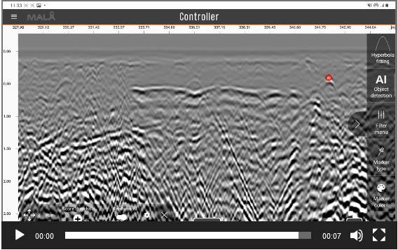
MALÅ Controller App, GPR Data Acquisitioning on your mobile device:
MALÅ Controller App is an easy-to-use acquisition software to help you go as fast as possible from data collection to delivering results. The intuitive user interface lets you view and interpret while data is being collected. Set gain and contrast, remove background noise and set object and surface markers. The touch-based interface speeds up your survey, letting you deliver results quicker.
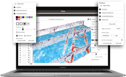
MALÅ Vision, Visualize and present GPR data in 2D and 3D:
MALÅ Vision is easy-to-use GPR processing software for handling of GPR data, developed for usage on any device for all types of GPR users. MALÅ Vision includes MALÅ AI for automated interpretation support and creation of polylines. The built-in MALÅ AI of the MALÅ Vision cloud-based post-processing software will provide further support by analyzing the markers and pointing to the location of possible pipes and cables in your data set. Document all buried assets. View your results on Google Maps or OpenLayers, use satellite images or Street view (first person view) of your site. Export your results as printed maps, dxf or kmz for easy sharing.
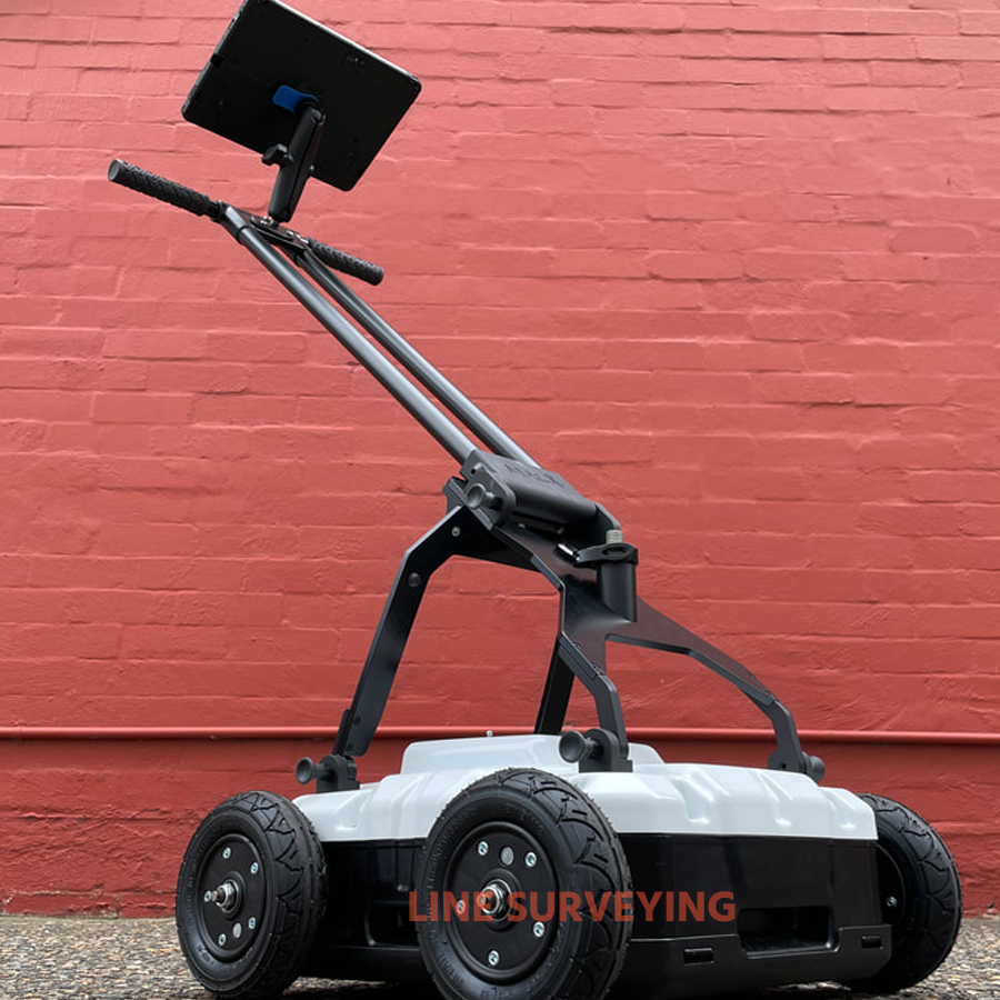
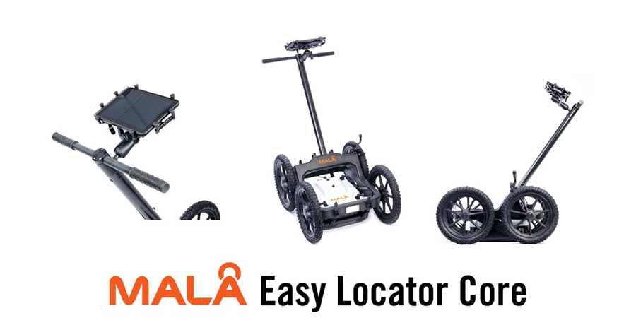
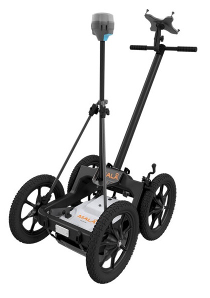
Rough Terrain Cart (optional)
Traverse any terrain. The Easy Locator Core works on any surface and in any terrain. In its basic configuration it is ideal for confined spaces and flat surfaces, Together with MALÅ RTC Mini it is the market leading cart solution for rough terrain surveying.
Applications:
- Utilities: GPR can be used to locate and map the depth of water, gas, electric, communication lines, sanitary and storm sewers or unknown and abandoned pipes. GPR is also efficient for mapping the location of underground storage tanks and for pre-studies for horizontal directional drilling (HDD).
- Concrete investigation: GPR can be used to locate and map the depth of rebar’s and other installations in Concrete GPR is well suited, for instance, to map the thickness of concrete slabs/elements, void detection and concrete fracture mapping.
- Roads and Railways: GPR is widely used for mapping road and asphalt layering, as well as railroad ballast surveys. Further on, GPR is suitable to investigate the internal structure of roads and railways and investigate the geological investigations prior to construction. GPR is also commonly used for bridge decks surveys and runway investigations at airports.
- Archaeology: GPR is often used to map archaeological landscapes, sites, features and objects.
- Geology: GPR can be used for stratigraphic mapping, structure analysis, cavity and sinkhole detection, depth to bedrock investigations, mapping of bedrock fractures, mining hazards etc.
- Water: GPR is well suited to map lakes and rivers, for bathymetry investigations as well as investigating the river and lake floor structures. GPR can also be used for geological investigations for the detection of groundwater.
- Earth and concrete dams: GPR can be used to investigate the internal structure and layer of dams, as well as voids.
- Tunnels and Mining: GPR is used for fracture detection, structural investigations and concrete thickness evaluation.
- Environmental: GPR can aid in mapping hazardous waste, underground storage tanks and other utilities. Further on, it is suitable to use a GPR to map the bedrock surface for estimating flow directions and also for lake sediment surveys.
- Military: GPR is often used for UXO (unexploded ordnance) detection, runway integrity analysis and clearing of trenching routes etc.
- Ice and Snow: GPR is an excellent tool for structure analysis of ice and snow, as well as ice and snow thickness estimations and crevasse detection etc.
| SPECIFICATION: |
| Data acquisition |
MALA Controller App |
| Post-processing platform |
MALA Vision |
| Tablet included |
Samsung Galaxy Tab Active Pro |
| Artificial intelligence |
Real-time MALA AI |
| Core technology |
MALA HDR real-time sampling |
| Output |
32 bit |
| Working time |
> 8 hours |
| Dimensions (operating mode) |
102 x 49 x 79 cm |
| Dimensions (after folding) |
29 x 49 x 83 cm |
| Weight (without tablet) |
15Kg |
| Max measurement speed |
> Highway speed |
| Tightness class |
IP65 |
| Positioning |
RTK GNSS (option), DGNSS, mobile device positioning, encoder, Total station support |
| Acquisition mode |
Encoder wheel, time |
| SNR (signal-to-noise stack) |
> 102 dB |
| Capacity |
> 121 %, fractional, -10 dB |
| Power |
Dual interchangeable 12 V Li-Ion, external 12 V DC source |
| Additional equipment |
MALA Rough Terrain Cart Mini (option) |
| Antenna frequency |
450MHz |
| Download PDF |
|